Living Here
Become a citizen scientist on your next beach visit with CoastSnap

As the cooler months quickly approach, the temptation to take to the water decreases, but thanks to the introduction of CoastSnap, you still have an excuse to feel the sand between your toes.

CoastSnap is a community beach monitoring program designed to capture our changing coastlines through the installation of six CoastSnap stations across the Gladstone Region.
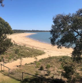
The program relies on repeat photos at the same location to track how the coast is changing over time. This could be due to erosion of sand caused by storms, rising sea levels, and human activity, or sand deposition through wave and wind action.
Gladstone Region Councillor Natalia Muszkat said each CoastSnap station has a purpose-built cradle to fit smart phones, such as an iPhone.
“Each station has instructions to guide people on how to take a photo and where to upload it,” Councillor Muszkat said. “Uploading photos can be done via the CoastSnap App or by posting to social media using a hashtag unique to each site.
“Snaps submitted will help Council to understand how the coastline changes and manage coastal environments for future generations, while also helping the community stay connected with Council’s Our Coast Our Future Strategic Plan and the potential impacts of coastal hazards.”
Cr Muszkat added that each station features traditional owner place names in Gurang or Toolooa language, as a mark of respect to our local First Nations people and the land on which the stations are located.
The stations are located at Agnes Water (Koonggullunee), Barney Point (Doloa), Canoe Point (Goondool), Seventeen Seventy (Meeroonyanee), Turkey Beach (Wagun) and Wild Cattle Inlet (Winyim).
Visit www.gladstone.qld.gov.au/coastsnap for more information about CoastSnap locations and to view the photos that have been snapped.


